Report | October 16, 2017
Fishing intensity in Mediterranean Natura 2000: How monitoring can support management & conservation
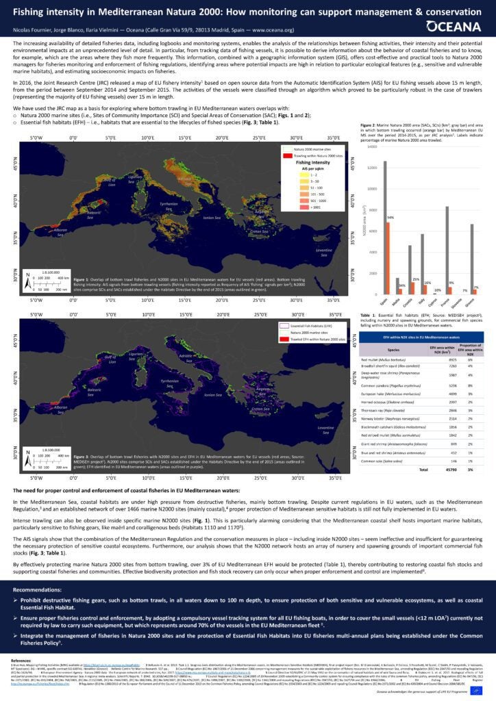
The increasing availability of detailed fisheries data, including logbooks and monitoring systems, enables the analysis of the relationships between fishing activities, their intensity and their potential environmental impacts at an unprecedented level of detail. In particular, from tracking data of fishing vessels, it is possible to derive information about the behavior of coastal fisheries and to know,
for example, which are the areas where they fish more frequently. This information, combined with a geographic information system (GIS), offers cost-effective and practical tools to Natura 2000
managers for fisheries monitoring and enforcement of fishing regulations, identifying areas where potential impacts are high in relation to particular ecological features (e.g., sensitive and vulnerable
marine habitats), and estimating socioeconomic impacts on fisheries.